Wawa damN =)
Just coming from what seemed like a looong and stressful week, my BF Ben had the itch go out of town and be with nature again. So with details that were last minute coupled with the participation of others precluded by things they needed to attend to, the two of us headed for Wawa Dam after lunch on a Saturday, taking an approximately 40 minute FX ride from Taft to Litex, costing P35 each.
From Litex we took about a 30-minute, P17 each, jeep ride headed for Montalban, Rizal province. On the way, our senses were greeted by the aroma of the Payatas disposal facility lined with a crude fence and gates, some fully covered, for yards along the road. We didn’t see any mounds of garbage, but little traces of bagged plastic or piled cardboard could be seen here and there just within or outside the fence.
Avilon Zoo has been our list of places to go for months now, having gone to Manila Zoo quite a number of times. When we passed the sign that indicated our route was the way to get there, we made a mental note to return to see it one day.
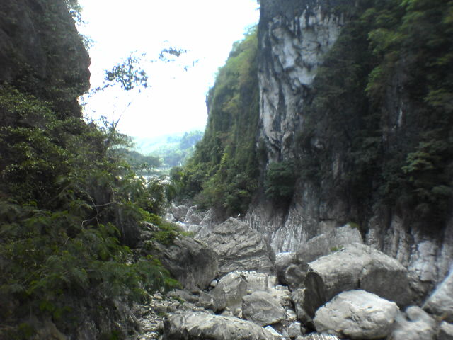
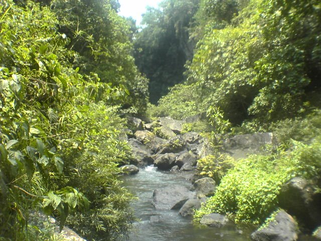
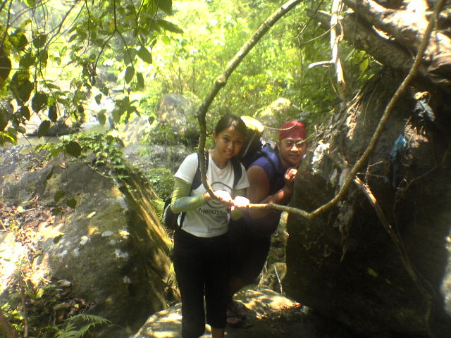
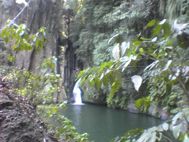
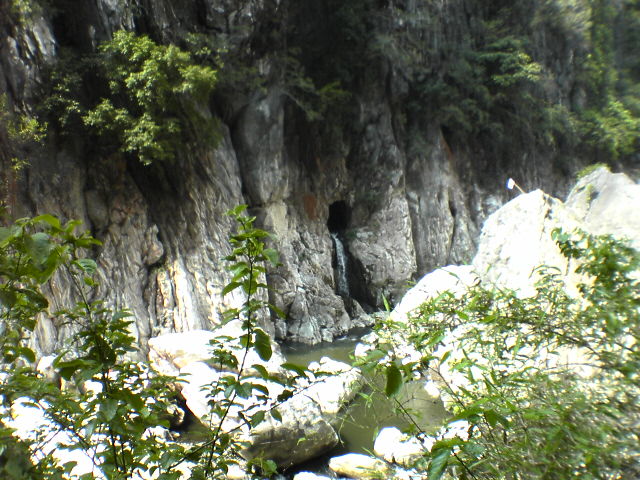
 Not too far from the sign “this way to Avilon Zoo” we got down at the nearest stop and took a 20-minute jeep ride for P7.50 to “The Municipality of Montalban” where we got down at a clearing beside part of the river. We just had to walk upstream, parallel to the river to get to the actual dam. Initially the path was lined on both sides with makeshift houses, sari-sari stores and hangouts that offer karaoke and billiards. Past those, to our left view we saw there wasn’t much of a flowing river. There were large rocks on the wide riverbed and some areas where the water was big and deep enough for people to swim in. There wasn’t a place to walk on the other side of the river as it was just a steep mountainside though we did see small falls pouring out of a hole into a small basin We also saw indications of Japanese presence as there was Japanese writing above a hole / cave rather high up the mountainside.
It would have been nice to travel down stream in the river and explore the other side, though I imagine it would be not as easy, not for it’s width but it’s uneven river bed with rocks of all sorts of sizes and the pools of water in between.
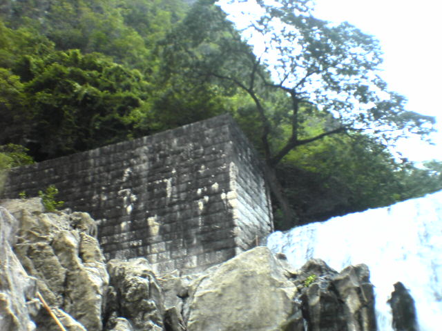
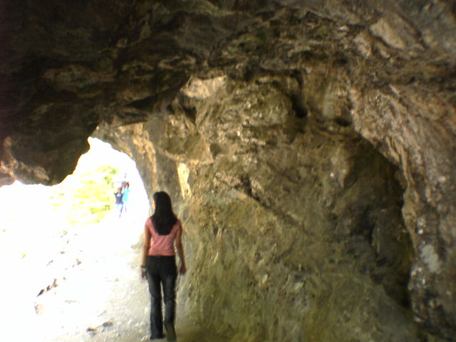
 Continuing up the path, we came across many caves to our right, going deep into the mountain. There was one particular cave that we could have easily walked into standing. We also passed by an arch built from old cement bricks/slabs blocked with bags of dirt and a “1909” written above it, making us more and more curious about the details of the place’s history.
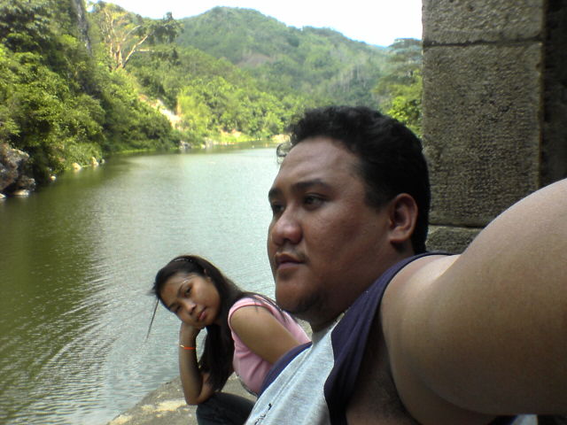 Further up the path we reached a tunnel that was dug into the mountain. While the path leads you beyond the top of the dam, we settled for the view of the tower that has 3 deep-tunneled holes that you have to be careful not to fall into
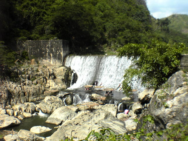
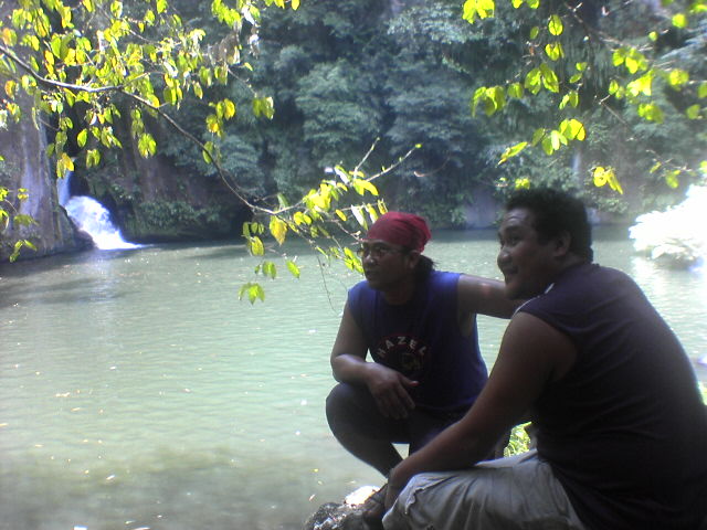
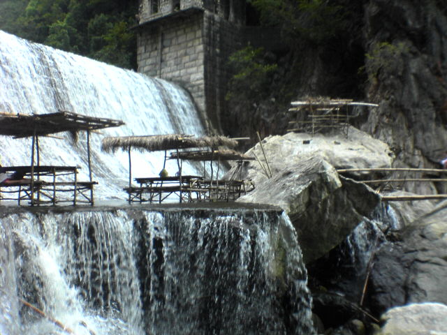
 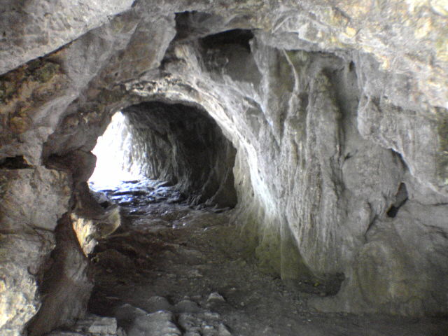 because most of it is not covered. The ledge on this tower gives you a great view of a green and murky and rather calm river, before it overflows over the dam.
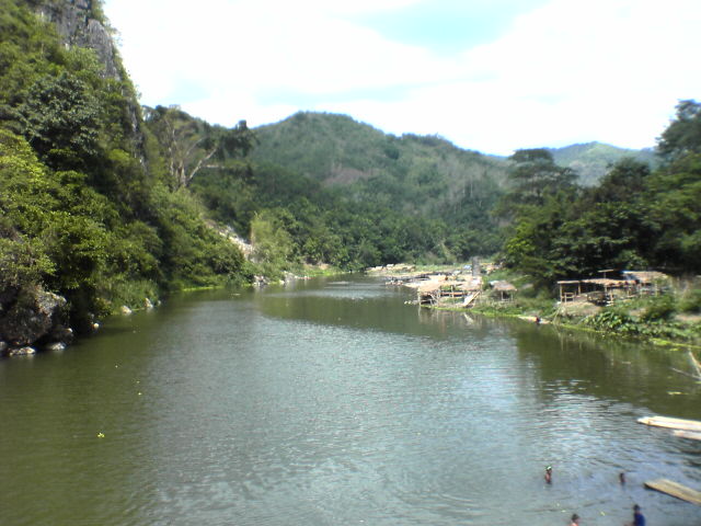 After backtracking a bit and clambering down the rocks over a small bamboo bridge, we reached the bottom of the
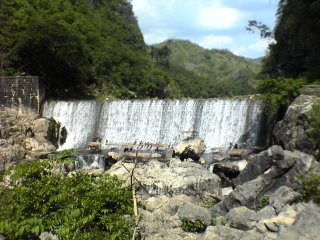
  damn. A very nice feature of it is that it’s slightly tilted wall was purposefully rutted giving water a nice frothy and sluggish curtain-look as it fell. The base of the dam was a cemented ledge where the water flows coming from the dam wall runs 3-4 inches. Another nice feature was the presence of benches and tables on the ledge made of bamboo with a thatched roof for people to picnic.
The water was nice and warm as it ran over the damn wall, heated by the afternoon sun.
 Caretaker Ronnie showed us 2 “kubos” (huts) available to stay overnight, though apparently not many do, on the other side on the only ledge that protrudes from the mountainside opposite below and opposite of the tower. There is also a ledge as wide as 4 ledges to set up a tent just below the kubos. Apparently though, when it rains hard, the river level can even reach heights of about 3 meters and more. While there were many groups of people that came, the also left. Coupled with the fact that the sky towards 5pm threatened rain, we were set to leave by 5:30 PM. We take the same rides back only for some reason, the FX from Litex to Taft is only P30.
One thing I’d like to note on our way back was the quarry area we past. I guess aside from the dumpsite, it would explain the many huge trucks that you pass on the road.
Despite the sketchy plan to go there, I’m glad we went and its definitely on or list of places to see visit again.